


KOLKATA: The India Meteorological Department (IMD) has issued warnings as the very severe cyclonic storm “Biparjoy” intensified over the Northeast Arabian Sea. The cyclone is projected to move nearly north-northeastwards, crossing Saurashtra and Kutch and the adjoining Pakistan coasts between Mandvi (Gujarat) and Karachi (Pakistan), near Jakhau Port (Gujarat), by the evening of June 15.

IMD has classified “Biparjoy” as a very severe cyclonic storm with maximum sustained wind speeds of 125-135 kmph, gusting to 150 kmph.
Its impact is expected to be significant in Gujarat, with IMD issuing storm surge warnings for districts including Kachchh, Devbhumi Dwarka, Porbandar, Jamnagarh, and Morbi districts.
During the time of landfall, a storm surge of approximately 2-3 meters above the astronomical tide is likely to inundate low-lying areas in these districts. Furthermore, astronomical tides in different locations along these districts could reach heights of 3-6 meters.
ALSO READ: Amit Shah reviews preparations for Amarnath Yatra
The sea conditions in the northeast and adjoining east-central Arabian Sea will be phenomenal until the evening of June 15. IMD has said that the sea will turn rough to very rough over the adjoining northwest Arabian Sea and other parts of the east-central Arabian Sea during the same period.
Along the Saurashtra and Kutch coasts, the sea conditions are expected to be rough to very rough until the morning of June 14, becoming high to phenomenal thereafter until June 15. Improvement is expected after this period, according to the weather department.
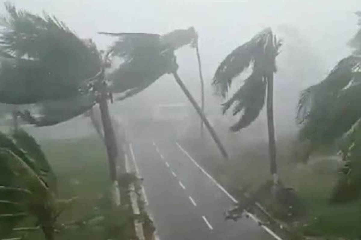
Damage is anticipated in districts including Kachchh, Devbhumi Dwarka, Porbandar, Jamnagar, Morbi, Junagarh, and Rajkot in Gujarat on June 15. The cyclone may cause total destruction of thatched houses, extensive damage to kutcha houses, and some damage to pucca houses. There is also a potential threat from flying objects. Power and communication poles may bend or uproot, and people are advised to exercise extra caution to ensure their safety, as per IMD.
The cyclone may result in major damage to kutcha and pucca roads, flooding of escape routes, disruption of railways, overhead power lines, and signaling systems. Standing crops, plantations, orchards, green coconuts, and palm fronds are likely to suffer widespread damage.
ALSO READ: BJP alleges RaGa’s hand behind ex-Twitter CEO’s ‘pressure’ claims
Additionally, bushy trees like mango may be blown down. Small boats and country crafts may detach from their moorings, and visibility will be severely affected due to salt spray.
A fishermen warning has been issued for Kachchh, Devbhumi Dwarka, Porbandar, Jamnagar, Rajkot, Junagarh, and Morbi districts, as well as for offshore and onshore industries.
Fishing operations have been completely suspended over the east-central and adjoining west-central Arabian Sea until June 15, and in the northeast Arabian Sea from June 14 to 15. Fishermen currently at sea are advised to return to the coast.
Precautions are being taken to regulate offshore and onshore activities, and ports along the west coast of India are advised to take necessary precautions. Naval bases are also maintaining necessary precautions.
Residents in the affected areas are advised to remain indoors, and tourism activities may be restricted in these areas.
YOU MAY ALSO LIKE:


